Prepared by John A. Miller
First draft composed on May 2015
Battlefield Park Background
The Monterey Pass Battlefield Washington Township Park is a historical, cultural and natural resource park located in Franklin County, Pennsylvania near Blue Ridge Summit established in 2012. The park consists of about 120 acres of land that will feature interpretive trails, living history areas, and museum that will help to tell the story of the Battle of Monterey Pass, fought on July 4-5, 1863. The land was purchased by Washington Township with two community improvement grants from Franklin County. 116 acres of land was purchased from Washington Township Municipal Authority and another 1.5 acres of land from the Blue Ridge Summit Lions Club. Across the road there is 1.8 acres of land that has a fully interpretive museum which opened in October 2014. Together, these three properties make up the approximate 120 acre battlefield park.
Historical Information
The Monterey Pass Battlefield Park has a lot of history associated with it that spans from 1747-1945. The Maria Furnace Road was once part of the Great Wagon Road that led out of Philadelphia, Pennsylvania. This allowed Scots-Irish, Germans and some English to travel to Appalachia. The road became an official Pennsylvania highway in 1780’s. By 1820, the area became home to several inns and farmers.
During the years leading up to the Civil War, the area was part of the Underground Railroad. In 1859, Captain John Cook, who fled out of Harper’s Ferry during John Brown’s Raid was in the area as he kept to South Mountain to avoid capture. He was captured at Mont Alto Gap. The radical Thaddeus Stevens owned property along and near Maria Furnace Road. He operated several furnaces. Caledonia State Park was where his major business was located at.
During the Civil War, the Maria Furnace Road was used by both Union and Confederate troops. It was the actions that occurred after the Battle of Gettysburg that the road is most remembered. On the night of July 4-5, 1863, a major battle had erupted at Monterey Pass. After several hours of fighting at night during severe weather, the Union cavalry was unable to block the mountain pass, but were able to destroy and capture several miles worth of wagons. Union Major Charles Capehart, 1st West Virginia Cavalry would receive a Medal of Honor in 1898. To review a more in depth history, please refer to the Monterey Pass Battlefield Management Plan.
After the Civil War, industry boomed with the arrival of the Western Maryland Railroad, mining and the harvest of timber for charcoal to be used to power the furnaces. With so much industry, this also led to wealth and the Resort era in which inner city residents built large mansions and hotels. Monterey was the main getaway for those in the city.
During the Depression, the wealth of Monterey Pass declined. The next and perhaps the last major large event took place during World War Two. American troops from nearby Camp Ritchie conducted military exercises in and around Monterey. Americans dressed as Germans and Italian soldiers conducted mock battles to train personnel for the war in Europe. During World War Two, several of the inns and hotels fell due to fire and were erased from the landscape. Route 16, Sunshine Trail opened during this period and the old road was discontinued and closed.
Interpretive Themes
 The initial plan is to interpret this land using three main interpretive themes and the interpretive trails would be implemented in phases with regards to production of signage. The first theme is the Battle of Monterey Pass since the property was a battle position established between 12 midnight and 3:30 a.m. Areas of Maria Furnace Road is also considered as a battle line established between 3:30 a.m. and dawn. The second theme is the Retreat from Gettysburg and the final theme is the Union Pursuit. Thousands of Civil War soldiers marched and encamped along Maria Furnace and the Emmitsburg & Waynesboro Turnpike on the night of July 5-6, 1863.
An additional theme could be situated around colonial America to World War Two in certain areas that would not take away from the Civil War era. This would allow visitors to fully understand how important the area was during its 250 years of existence.
As interpretive waysides are produced and mounted, trails could open as early as a few months for the private and personal benefit of the public depending on financial support from the Friends of the Monterey Pass Battlefield, Inc. A map with historical information and trail information should be produced into a brochure that could help educate and navigate visitors to the Monterey Pass Battlefield Park.
Trails will be named in order to help the public understand the main interpretive themes. The battle line in the area closest to the parking lot is to be called the “Billy Yank Trail.” A trail leading to the Maria Furnace Road is to be called the “Johnny Reb Trail” while the road itself will be called the “Maria Furnace Road Trail.” Another trail leads to Monterey Peak will be named “Monterey Peak Trail”. It is recommended that a secondary trial from Monterey Peak be built to allow visitors to gain access to Maria Furnace Road near “Area A.” Key points are as follows that will allow visitors to understand and explore the Monterey Pass Battlefield Park. No need for power tools as we will blaze the trees. An easement has been granted from WTMA and Washington Township to an existing roadway to allow handicap and elderly visitors to experience the battlefield by safely see the Maria Furnace Road. This roadway begins at letter “E” below and would be stone dusted for easy mobility for wheelchairs and strollers.

The Monterey Peak Trail will require much work. As you ascend uphill, the trail is overgrown with tall invasive weeds. Once you are at the top, one can see the boulders that make up the peak. A trail will need to be found or cut in to allow visitors access to this point. Once you are on top of the peak, trees and brush obscure the overlook that once existed. The overlook has a fine view of Blue Ridge Summit to the southeast, the Catoctin Mountain to the east and to the northeast is Gettysburg Valley.
The photograph shows the view looking toward the ballparks of Blue Ridge Summit and was taken in April. The view has been taken over by the leaves and heavy brush since May came in. As of now, winter is the best time to view this area.
The rock formations are among the oldest on the American continents according to Geological surveys conducted in the area from the 1870’s to 1940’s. The peak was formed millions of years ago when this area was below sea level. As time went, deposits of sand, later covered with mud and lime sediments forming shale. A major push brought these sandstones upwards, many of them stood miles high. After millions of years of weathering, the stones wore down. Further uplifts formed the mountain. As a result, the formation you see is the final product which stands nearly 1,600 feet above sea level.
Walking Tour
A. Located near here is Fairfield Gap where the Maria Furnace Road branched off from Furnace Road. It was there that the Confederate wagon trains moved toward Monterey Pass. During the battle of Monterey Pass, Confederate cavalry fought off a flanking attempt to block the road. After the battle, two-thirds of the Confederate army marched on Maria Furnace Road.
B. The 1st North Carolina Sharpshooters and a detachment of Alabama troops stopped the wagon train here and moved forward to Monterey Pass.
C. After the Union cavalry broke through the Confederate battle line at the toll house, it was here the 1st North Carolina Sharpshooters entered the fight and came under heavy artillery fire from Pennington’s battery deployed at the Monterey Pass Toll House. Realizing that Confederate infantry was pouring on scene from Maria Furnace Road, Kilpatrick ordered the rest of his cavalry down the mountain to Ringgold, MD. With Monterey Pass secured the Confederate army will continue their withdrawal from Pennsylvania.
D. This area is where the Union cavalry began getting bogged down in the fight. It was here that much hand to hand combat took place. Due to the terrain, the Union right flank would rest at the base of the hill in front of you. Portions of the 1st Maryland Cavalry, Company B deployed here while the Confederates established a new battle line at the toll house.
E. It was here, where Colonel Russell Alger realized that the bridge spanning Red Run was still intact. He asked for reinforcements in order to make a charge on the Confederate position.
F. It was here where Colonel Alger supported by a portion of the 6th Michigan Cavalry formed a hasty battle line that allowed the 1st West Virginia Cavalry and the two companies of the 1st Ohio Cavalry to charge and attack the wagon train.
Management Issues & Threats
 The battlefield has one of the characteristics which falls into the Wilderness Character (refer to the Wilderness Act of 1964) and could be helpful in managing our resource since it does border Michaux State Forest. The character is to provide some outstanding opportunities for solitude or a primitive and unconfined type of recreation. This solitude is a great resource which will allow visitors to reflect on the experiences of those who marched through these woods and fought a major battle here. To achieve the exception of the visitor experience some management, actions are needed in order to protect the resource and the visitor. In return, we need to serve as stewards in order to protect the battlefield for future generations.
Visitor management is accomplished by identifying threats, planning, taking administrative action, and monitoring. The Monterey Pass Battlefield should recognize the value of wilderness and the historical value for visitors and seek to maximize opportunities for personal discovery, challenge, and other experiences, while ensuring that opportunities for solitude and the natural, historical and cultural resources are not degraded.
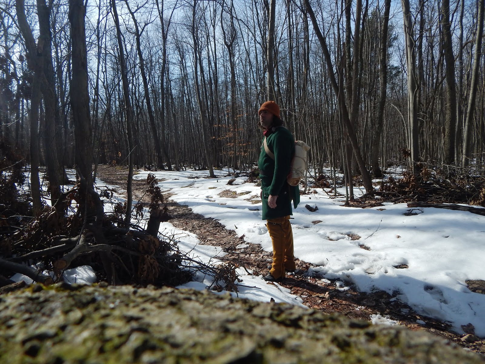
After inventorying the newly acquired 116 acres of land acquired from the Washington Township Municipal Authority and the 1.5 acres of land from the Blue Ridge Summit Lions Club, formerly part of the Rolando Woods Lions Club Park, several of the historical features still stand out. Although, the woods are new growth and not that of the Civil War era, it still demonstrates what the terrain was like during the Battle of Monterey Pass. Wooded and several patches of undergrowth are two main characteristics often written about by those Civil War soldiers that fought there or marched through the area.
Several trails and old logging roads do exist and shows signs of heavy foot traffic, hunters and ATVs. These trails should be used for foot traffic only, to and from the Maria Furnace Road to the parking area since they are a preexisting condition to the resource. Some trails lead to private property. To restrict traffic and trash dumping on these trails, a simple wayside or kiosk planted in the middle of the trail will not only restrict traffic, but will help us to identify which trails are still being used for illegal park use. A walk through should be conducted at least once a week to see if new problems are continuing or declining.

Maria Furnace Road is the dividing point between the Monterey Pass Battlefield Park and D.L. George’s private property. No trespassing signs are posted and should be respected. However, the boundary does go up the center of the road and at some points, cross over onto the Monterey Pass Battlefield Park property. A usage agreement should be sought since the road itself was one of the major factors as to why it made the property important for preservation and listed as one of Pennsylvania's most endangered historical sites.
Maria Furnace Road does show signs of vehicle use. This could be a safety concern for those who are walking the road and happen to see a vehicle coming. Vehicle traffic could cause long term damage to the historic resource of the Maria Furnace Road. Once the road bends, there are a few washed out areas that need attention and several trees removed that are laying over the road. The road continues back to Michaux State Forest, a public land in which Pennsylvania owns. Also, private landowner, Mummert owns several acres of land and could easily be marked for the public with kiosk and wayside planted in the road to prevent foot traffic to move further.
Educating the public on private property boundaries and educating our neighbors of this important historic resource could prevent a lot of the misuse of the property including hunters access. Flyers could be made and mailed to all the property owners that border the battlefield. Education of the park is key for a healthy relationship with our neighbors. Our visitors will also need to be educated with regards of property boundaries. A simple kiosk with a brochure that features a map of all the trails, their distances and trial type will help visitors to navigate around the property while at the same time respecting the private property of those who live outside of the battlefield boundary.
Inventory

Management is key to this property and preserving the landscape for the personal usage of the people. The property offers several key features of the historic resource that were described by Civil War soldiers who fought on the property. A hill with a rock crop prevented the Union cavalry from attacking the Confederate wagon train that was just on the other side during the night in a thunderstorm. This feature along with the landscape will help to educate the public about the importance of the terrain never before seen by visitors and or tour groups.
Each month, inventory of the resource should be taken in order to determine what needs and what steps should be taken in case of deteriorating conditions that could harm the historical nature of the property from visitor or illegal use. Inventory of the property is also needed to determine what is it exactly that the property has with regards to the management of the forest, wildlife and visitor usage.
Inventory allows us to preserve the historical and wilderness features of the site. For example, if our living history area shows signs of dead or dying vegetation or erosion on the Maria Furnace Road, then management steps should be taken to reduce the threat by moving the living history area to another area. If a new trail known as a renegade trail should appear, then actions would be taken to prevent its usage.
Determination of Action
The only time action should be taken is if the historical or natural resource of the property is in danger or if there are changes to the historical resource. Once problems arise, then management action or alternative action should be taken depending on the danger or situation of the resource. Daily actions such as Leave No Trace practices will help to cut down on problems and being proactive will also help to keep the historical resource protected for generations to come. There is a set of park rules and regulations known as Resolution 544, adopted March 5, 2012 posted on the land. If these rules or regulations are not followed, the Township code 232-25 will also allow law enforcement to take necessary actions to protect the resource.
Evation and Implement Actions
A Management, Conception, Interpretation and Preservation Plans do exist for the Monterey Pass Battlefield and were adopted by the Board of Washington Township Supervisors in 2011. These plans will help to implement policies for the preservation of the Monterey Pass Battlefield. These plans were meant to change as conditions arise.
Monitor and Adapt
As with inventory, monitoring is just as important. Monitoring allows us to collect data in order to create a plan designed to help us to identify changes to a resource and what action is needed in order to protect the historical resource. It will also help to guide us for future plans and what decisions will help to restore a deteriorating condition whether caused by human or nature.
Conclusion
These steps if used together, will help us to preserve the historical character of the Monterey Pass Battlefield Park. As stewards of the park, the number one goal to preserve the historical value of the land and protect the historical and natural resources that make up the Monterey Pass Battlefield.